MPL Digital Collections
Milwaukee Maps
Jump to: More Information
The Milwaukee Maps collection was developed as a collaborative project between the American Geographical Society Library (AGSL) , located at the University of Milwaukee-Wisconsin, and Milwaukee Public Library. The maps in this digital collection are from the Milwaukee Public Library’s historic maps holdings, located in the Humanities Department of the Central Library.
Back to all Digital Collections
More Information
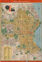
The Milwaukee Maps collection was developed as a collaborative project between the American Geographical Society Library (AGSL) , located at the University of Milwaukee-Wisconsin, and Milwaukee Public Library. The maps in this digital collection are from the Milwaukee Public Library’s historic maps holdings, located in the Humanities Department of the Central Library.
The maps in this collection depict various aspects of Milwaukee’s history and development, including housing, redlining, civil rights, the March on Milwaukee, transportation, schools, and other civic institutions.
The physical collection of maps may be viewed in the Frank P. Zeidler Humanities Department at the Central Library. For more information, contact the Humanities Department at (414) 286-3061 or read more about the map and atlas resources available at the Central Library.